Route
2: (approx 88 miles)
Llanwrtyd Wells Road to Abergwesyn. Take Mountain road to Tregaron. Take B4343
to Lampeter. From Lampeter take the S482 to Pumsaint. Carry on the A482 Llandovery
Road and take first road left (past goldmine entrance) to Llyn Brianne Reservoir.
Carry on past reservoir to meet the Abergwesyn to Tregaron Road again. Turn
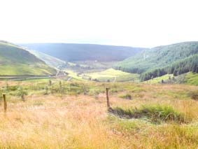
right to Llanwrtyd Wells. At the beginning of this ride is about two miles
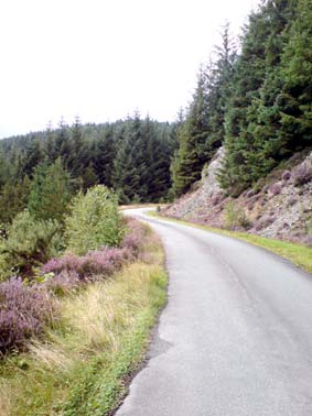
of river running alongside the road. Then 14 miles of single track mountain
road. The first part is called The Devils Staircase a 25% gradient with hairpin
bends. Not for the fainthearted. Very steep in places. 2nd gear most of the
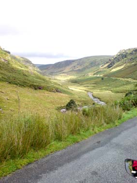
way. The ride through the "A" road was green fields and rolling
hills. The small road down to Llyn Breanne runs a lot of the way by rivers
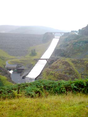
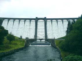
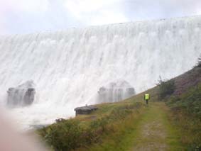
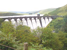
and is very pretty. The road from Llyn Breanne Dam back to Abergwysn was 6
miles of mountain road running along the length of the reservoir. unning scenery
but we rode the whole way in heavy rain! The last part was through the mountain
pass again and one part was downhill on the 25% gradient of the Devils Staircase
.
Route 3:
(approx 84 miles)
Llanwrtyd Wells to Llangmarch Wells. Turn left to Upper Chapel. Turn right
at T junction B4519 via Lower Chapel B4520 to recon. Through traffic at Brecon
to roundabout, second exit. Carry on until signs for Visitor Centre (teabreak)
(27 miles). Turn right out of visitor centre and then turn left. Carry on
to T junction - turn right (A40). Next T junction turn left. This road passes
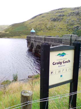
Cray Reservoir on the right. Turn around. Head for Trecastle A40. Turn left
by Antique Centre. This goes to the Usk Reservoir (not signposted). Return
along the same road, turn left onto A40 to Llandovery. Lunchstop at Llandovery.
Continue on to Llanwryted Wells on the A483. Lovely secenery all day but wasted
a lot of time and miles lup and down trying to find the Usk Reservoir. "A"
road coming back has lovely scenery.
Route
4: (approx 76 miles)
Llanwryted
Wells to Abergwesyn. Left towards Devils Staircase (25% gradient). Turn left
down mountain road running along Lynn Brianne Reservoir. At the dam return
along same route. Turn left signposted Tregaron. Turn left to Tregaron. Teabreak
stop. From Tregaron turn up the road in the square to LlanddewiBrefi. Turn
left up the road to highest point EsgairCnwc. Back the same way to Tregaron.
Turn right back along the mountain road. Down the Devils Staircase back to
Llanwrtyd Wells.